Walled wonder
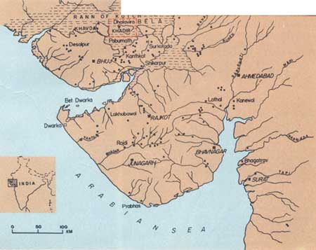
 DHOLAVIRA, the first known Indian city, ranks with Mohenjodaro, Harappa, Ganweriwala (now all in Pakistan) and Rakhigarhi (India) as one of the 5 largest urban centres of the Harappan civilisation. A series of excavations by the Archaeological Survey of India uncovered Dholavira as a major Harappan city, exquisitely planned, with monumental structures, aesthetic architecture and an amazing water-management system. The ancient ruins of Dholavira are spread over about 100 ha, nearly half of which is appropriated by a fortified settlement.
Dholavira was laid out on a sloping terrain between two storm-water channels -- Mansar in the north and Manhar in the south. The city was enclosed by a massive wall, designed like a large parallelogram and measuring 771 metres in length and 616.80 metres in width.
It is evident that the site of the settlement was picked after a good deal of forethought and planning. The gradient between the higher east and the lower west of Dholavira is 13 metres, which is ideal for reservoirs. In fact, along the inside of the city's walls is a series of water reservoirs, which almost entirely surround the 3 principle divisions of the city, designated as the Citadel, the Middle Town and the Lower Town.
The Citadel, which stands majestically on the south side, consists of 2 fortified divisions on the east and west and christened Castle and Bailey, respectively. The Middle Town, also fortified, lies to the north and is separated from the Citadel by a long and wide ceremonial ground. To the east of the Middle Town is the Lower Town, which is not fortified.
Besides, the excavations revealed 7 cultural stages, caused by a succession of settlements that came up over a millennium, through which the first Indian urbanisation saw its rise, culmination and fall. Dholavira also enjoys the unique distinction of yielding the world's oldest signboard, comprising an inscription of 10 large-sized signs of the Harappan script.
