State of the Climate in Asia 2024
<p>The World Meteorological Organization’s State of the Climate in Asia 2024 report warns that the region is warming nearly twice as fast as the global average, driving more extreme weather and posing

<p>The World Meteorological Organization’s State of the Climate in Asia 2024 report warns that the region is warming nearly twice as fast as the global average, driving more extreme weather and posing
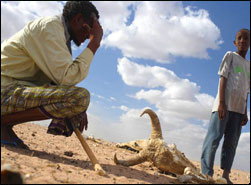
The National Center for Atmospheric Research, an important hub for work on the causes and consequences of climate change, has shut down a program focused on strengthening poor countries' ability to forecast and withstand droughts, floods and other climate-related hazards. The move, which center officials say resulted from the shrinking of federal science budgets, is being denounced by many experts on environmental risk, who say such research is more crucial than ever in a world with rising populations exposed to climate threats.
JORHAT, Aug 2: The current wave of floods has caused the inundation of thousands of hectares of agricultural land in the district. According to statistics, updated till July 30, available with the District Agriculture Office here, a total 24,349 farming families of 219 villages spread across the three subdivisions have been affected by the deluge.
Some 16 villages were inundated as river erosion damaged the old town protection dam on four points. While visiting Kachia and Dhania on Wednesday, the UNB correspondent found that hundreds of the marooned people had taken shelter on the cross-dam. Some affected people took shelter upon bamboo-made platforms inside their houses. Local sources said the villages went under water as erosion by the Meghna river damaged the dam in Ilisha Murad Shafiullah and Kachia Guramira hat areas.
Chenab River is likely to attain high flood level at various places during next 24 hours, while Indus River at Guddu and Ravi River at Balloki are still at low levels. Flood Forecasting Division (FFD) said on Sunday that all other major rivers are flowing below low flood level. High flood ranging from 200,000 to 280,000 cusecs is expected in Chenab River at Marala, 220,000 to 280,000 cusecs at Khanki and 200,000 to 260,000 cusecs at Qadirabad.
This study identifies the most likely humanitarian implications of climate change for the next 20-30 year period. The authors use Geographical Information Systems (GIS) to map specific hazards associated with climate change
The Koshi Basin is the largest river basin of Nepal. It originates from the Tibetan Plateau of China. The Koshi river is also known as the "sorrow of Bihar". Floods from the Koshi river in the past have created havoc in the downstream area of Nepal and India leading to loss of lives and property and causing widespread human suffering. This report provides a preliminary assessment of the impacts of the Koshi flood disaster and rainfall forecasts.
The Story of Bihar
The National Highway (NH) -60, part of the government
Staff Reporter Bangladesh is increasing in size contradicting forecasts that the parts of the country will disappear under water due to global warming. Scientists at the Centre for Environment and Geographic Information Services (CEGIS) say that the country's landmass has increased by 20 square kilometres (12.5 square miles) annually. They said that they have studied 32 years of satellite images and found that the country's landmass has increased by 20 square kilometres annually during that time.
The Kosi river basin in Bihar is facing its biggest flood disaster ever in Independent India, and that disaster has come about completely due to the neglect of the Government of India and the government of Bihar. It is a manmade disaster which could have been avoided.